Member Profile
Name:
Email:
Phone:
Recognition No:
Expiry Date:
Membership Id:
Membership Type:
Name:
Email:
Phone:
Recognition No:
Expiry Date:
Membership Id:
Membership Type:


The Association of Geosciences & Geo Engineering provides professional services and technical support in the fields of geology, geophysics, hydrogeology, environmental studies, and geotechnical engineering. Our goal is to connect qualified experts with individuals, businesses, and organizations that require reliable scientific and technical guidance for land, water, and environmental projects.

Book a technical site visit with our experienced experts for professional assessment and guidance. Our team includes specialists in geology, geophysics, hydrogeology, environmental science, and geotechnical studies. During the visit, our experts carefully examine the site conditions, ground structure, and environmental factors to provide accurate technical advice. Any type of technical site inspection can be arranged through our registered or trained members, ensuring reliable and professional support for your project or land development needs.

We provide professional borewell and open well survey services for domestic properties up to 25 cents of land. Our survey is conducted using the Electric Resistivity Method, a scientific technique that helps identify underground water sources accurately. This method allows us to study the soil and rock formations below the ground and locate the most suitable point for drilling a borewell or digging an open well.
Our experienced technical experts visit your site and carry out a detailed survey using advanced resistivity equipment. Based on the readings, we analyze the underground water potential, depth of water-bearing layers, and the best location for drilling. This helps reduce the risk of dry borewells and increases the chances of finding a reliable water source.

AGGE provides complete assistance for Pollution Control Board approvals, including Consent to Establish (CTE) under White and Green categories. We support industries, institutions, and commercial projects with documentation, application processing, compliance guidance, and coordination with regulatory authorities. Our expert team ensures a smooth, time-bound approval process while helping clients meet all environmental norms and statutory requirements efficiently and professionally.
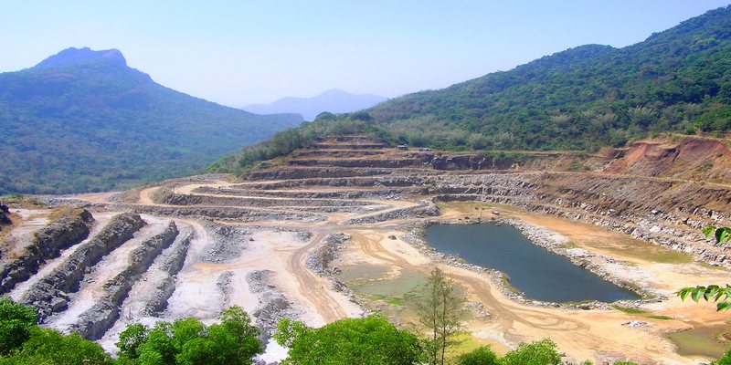
AGGE provide professional expertise in mineral exploration, geological mapping, resource estimation, and mine planning. Our services support clients across the mining lifecycle—from preliminary site investigation and feasibility studies to extraction planning and environmental management. With a strong technical foundation and commitment to industry standards, we deliver reliable data analysis, risk assessment, and sustainable solutions to ensure efficient and responsible resource development.
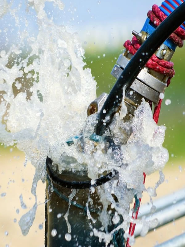
We offer professional hydrogeological services including groundwater exploration, aquifer characterization, borehole siting, pumping tests, and water quality assessment. Our expertise supports sustainable groundwater development, environmental impact studies, and water resource management for communities, industries, and infrastructure projects. Through detailed field investigations, data analysis, and comprehensive reporting, we provide reliable solutions for efficient and responsible groundwater utilization.

provides interdisciplinary education focused on understanding Earth systems and applying engineering solutions to real-world environmental and infrastructure challenges. The program integrates geology, geophysics, geotechnical engineering, and environmental sciences, equipping students with strong analytical, field, and technical skills. Through rigorous academic coursework, practical training, and research opportunities, AGGE prepares graduates to address issues related to natural resources, sustainable development, climate change, and geohazards.
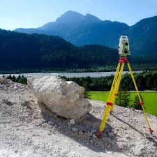
We provide detailed geological mapping and surveying services to support mineral exploration, engineering projects, and land-use planning. Our expertise includes surface and subsurface investigations, structural mapping, topographic surveys, and spatial data analysis using advanced GIS and remote sensing tools. Through accurate fieldwork and comprehensive reporting, we deliver reliable geological data to guide exploration, development, and infrastructure decisions.
We'll check if you're a registered member and apply the right pricing.
Join our digital platform today and experience seamless membership management.
Become a Member